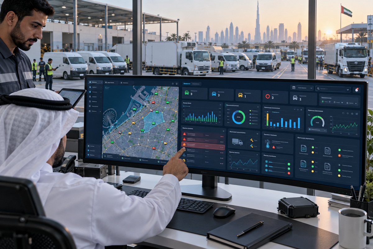
If you have ever opened a fleet management dashboard and seen all your vehicles moving on a live map, you have used AVL technology. If your dispatcher has ever directed the nearest available vehicle to an emergency call based on real-time position, that was AVL in action. If the Asateel portal in Abu Dhabi receives GPS data from your registered commercial vehicles and uses it for compliance monitoring, the underlying data layer enabling that is AVL.
Automatic Vehicle Location is the foundational technology of every GPS fleet tracking system and yet it is one of the least understood terms in fleet management vocabulary. Fleet managers regularly encounter the term in tender documents, technology specifications, and compliance discussions without a clear understanding of what it means technically and how it relates to the GPS tracking, telematics, and compliance platforms they are evaluating. This guide provides that understanding, with specific context for how AVL works in UAE fleet operations.
Key Takeaways
- AVL stands for Automatic Vehicle Location the technology that automatically determines a vehicle’s geographic position using GPS satellites and transmits that position to a management platform without any manual action from the driver or vehicle operator.
- Every GPS fleet tracking system is, at its core, an AVL system but not every AVL system provides the full telematics capability (driver behaviour, fuel monitoring, IVMS compliance) that enterprise fleet management requires.
- AVL accuracy in modern commercial fleet systems is typically 2 to 5 metres under open sky conditions sufficient for all operational fleet management applications including dispatch, route verification, and customer ETA tracking.
- UAE compliance programmes Asateel (Abu Dhabi ITC) and SecurePath (Dubai RTA) are fundamentally AVL data submission requirements: they require vehicles to transmit GPS position data to regulatory portals continuously.
- The distinction between basic AVL and full telematics determines whether a fleet operator has location awareness (AVL) or operational intelligence (telematics) and the choice between them should be driven by operational requirements, not just cost.
AVL Defined Automatic Vehicle Location Explained
The Technical Definition of AVL
Automatic Vehicle Location (AVL) is a technology system that automatically determines the geographic position of a vehicle and transmits that position to a central management platform at defined intervals without requiring any manual input from the driver or operator. The word ‘automatic’ is the defining characteristic: an AVL system operates continuously without human initiation it is not a system where a driver manually checks in with a position, but one that reports position automatically, typically every 10 to 60 seconds depending on configuration.
The position determination component uses the Global Navigation Satellite System (GNSS) most commonly GPS (the United States system), often supplemented by GLONASS (Russia), Galileo (Europe), or BeiDou (China) for improved accuracy and availability. The transmission component uses cellular data networks 2G GPRS in early systems, now predominantly 4G LTE with 5G emerging to send the position data packet from the vehicle to the cloud platform where fleet managers access it.
AVL is the foundational technology layer beneath every fleet tracking, fleet management, and telematics system. When a fleet manager views a live vehicle map, dispatches to the nearest driver, or receives an alert that a vehicle has left an authorised zone, AVL is the data source that enables each of these functions.
How AVL Uses GPS Satellites and Cellular Communication
The AVL process has two distinct technical stages that happen so quickly and automatically that end users typically have no awareness of them. The first stage is positioning: the GPS receiver module in the vehicle’s AVL device receives signals from multiple satellites simultaneously typically four or more for a 3D position fix and uses the precise timing differences between those signals to calculate the vehicle’s latitude, longitude, and altitude through a process called trilateration. This calculation happens continuously at the GPS module’s configured update rate, producing a new position fix typically every one to five seconds.
The second stage is transmission: the calculated position along with associated data including speed, heading, timestamp, and any additional sensor readings is packaged into a data record and transmitted over the cellular network to the cloud platform. The transmission interval is configurable: active tracking modes transmit every 10 to 30 seconds for real-time operational visibility; power-saving modes may transmit every few minutes when a vehicle is stationary. The cloud platform receives the transmission, stores it, and updates the dispatcher’s live map view within seconds of the position fix being calculated.
Modern AVL devices also incorporate fallback positioning methods for situations where GPS satellite signal is weak or absent such as urban canyons with tall buildings, underground car parks, and indoor environments. Assisted GPS (A-GPS) uses cellular network cell tower data to estimate position when satellite signals are insufficient. Wi-Fi positioning uses nearby wireless network identifiers. These fallback methods are less accurate than satellite positioning but maintain a usable position record in environments where pure GPS would produce a data gap.
Key Components of an AVL System
GPS Hardware The Vehicle Unit
The vehicle unit the physical device installed in the vehicle is the AVL system’s hardware foundation. It contains a GNSS receiver module for satellite positioning, a cellular modem for data transmission, an internal power supply circuit connected to the vehicle’s electrical system, and in more capable devices, additional interface ports for connecting external sensors (fuel sensors, temperature probes, driver ID readers). For Asateel compliance in Abu Dhabi and SecurePath compliance in Dubai, the vehicle unit must appear on the relevant regulatory authority’s approved device list not every commercial GPS device qualifies.
Hardware form factors for commercial fleet AVL include hardwired devices (permanently installed, connected to ignition and battery circuits), OBD-II plug-in devices (connected via the vehicle’s diagnostic port simpler installation but fewer features), and portable battery-powered trackers (for assets without power circuits). Hardwired devices are the standard for commercial fleet compliance applications because they cannot be easily disabled by disconnecting a simple plug and they provide access to the vehicle’s full electrical and CAN bus data.
Cellular Network GSM/4G/LTE Data Transmission
The cellular data network is the communication layer that carries AVL position data from the vehicle to the cloud platform. Modern commercial fleet AVL systems use 4G LTE as the primary transmission technology providing the data bandwidth for high-frequency position updates and the additional sensor data streams that full telematics systems generate. SIM cards in AVL devices may be single-operator (locked to one carrier) or multi-operator roaming (switching automatically to whichever carrier provides the best signal at any location) the latter being particularly important for UAE fleets that operate across emirate boundaries where different operators have different coverage strengths.
For cross-border GCC operations vehicles travelling between UAE, Saudi Arabia, and Oman international roaming SIM configurations maintain data transmission without requiring manual SIM changes, though roaming data costs are typically higher than domestic rates. Satellite fallback (via Iridium or similar networks) supplements cellular transmission for vehicles in areas beyond cellular coverage remote desert routes in Saudi Arabia or Oman where cellular infrastructure is absent.
Cloud Platform Where AVL Data Is Stored and Processed
The cloud platform is the central intelligence layer of the AVL system receiving position data streams from thousands of vehicles simultaneously, storing historical position records, applying rules-based alert logic, generating reports, and presenting the processed data to users through web and mobile interfaces. Enterprise AVL platforms process millions of data points per minute from connected fleets, with geo-processing algorithms that match GPS coordinates to road network maps, calculate derived metrics (distance, speed, heading), and apply geofence logic to detect zone entries and exits in real time.
The quality of the cloud platform determines how useful the AVL data actually is to fleet managers. A platform that simply stores GPS positions and displays them on a map provides location awareness. A platform that applies route matching, geofence alerting, replay tools, reporting, and integration APIs transforms the same GPS data into operational intelligence. Wialon the enterprise platform that VZone International operates on processes data from over three million connected objects globally, providing the processing scale and feature depth that transforms basic AVL position data into comprehensive fleet management capability.
Dispatcher Dashboard How Managers Access AVL Data
The dispatcher dashboard is the operational interface through which fleet managers and dispatch operators interact with AVL data in real time. The live map view showing all vehicles as icons on a geographic map, updated continuously as position data arrives is the primary operational tool. Icons are typically colour-coded by status (moving, stationary, engine off), with click-through access to individual vehicle details including current speed, last update time, current driver identity (if driver ID is configured), and active alerts.
Dashboard functionality beyond the live map includes journey replay (reviewing a vehicle’s route history for any past time period), geofence management (drawing zones on the map and configuring alerts for zone entries and exits), alert management (reviewing active and historical alert events), and reporting (generating structured reports on mileage, stop duration, route compliance, and other metrics from the historical position data). Mobile app versions of the dashboard extend this access to supervisors and managers in the field without requiring desktop computer access.
AVL vs. Full Telematics What Is the Difference?
AVL and telematics are not competing technologies telematics is built on AVL as its foundational data layer. The distinction is in what additional data the system captures beyond GPS position, and what operational intelligence that additional data enables.
| Feature | AVL (Basic) | Full Fleet Telematics |
| Real-time vehicle location | Yes | Yes |
| Speed monitoring | Yes GPS-derived | Yes GPS + CAN bus (more accurate) |
| Journey history and replay | Yes | Yes |
| Geofencing and zone alerts | Yes | Yes |
| Driver behaviour (braking, acceleration, cornering) | No | Yes accelerometer + CAN bus |
| Fuel level monitoring | No | Yes in-tank sensor integration |
| IVMS compliance data (ADNOC / OPAL) | No | Yes event-level driver behavior |
| AI dashcam video integration | No | Yes dual-lens AI camera |
| Vehicle health / engine diagnostics | No | Yes OBD-II / CAN bus |
| Maintenance scheduling alerts | No | Yes mileage + engine hours |
| Cold chain temperature monitoring | No | Yes IoT sensor integration |
| Driver identification per trip | No | Yes iButton / RFID / PIN |
| Asateel / SecurePath data submission | Yes location data | Yes location + full behavioral data |
| Typical monthly cost per vehicle (UAE) | AED 30–70 | AED 80–150 |
The practical decision for UAE fleet operators: AVL is appropriate when the primary requirement is vehicle location visibility, basic geofencing, and UAE compliance portal data submission (Asateel, SecurePath). Full telematics is required when the fleet has IVMS compliance obligations (ADNOC, OPAL), when driver behaviour coaching is an operational priority, when fuel monitoring for theft detection or efficiency is needed, or when AI dashcam safety management is part of the fleet safety programme.
Key AVL Use Cases for UAE Fleet Operations
Dispatcher Live Map Finding and Assigning the Nearest Vehicle
The live map dispatcher view is the most operationally immediate AVL application: when a new job arrives, the dispatcher sees every available vehicle on the map and can immediately identify the closest one to the job location. Without AVL, this determination requires radio or phone contact with multiple drivers to establish their positions a process that takes several minutes and may still not identify the optimal assignment. With AVL, the nearest vehicle is visually obvious from the map in seconds, and the dispatcher can make the assignment and communicate it to the driver immediately.
In UAE urban environments where traffic congestion can make the geographically nearest vehicle not the operationally nearest vehicle, dispatcher AVL views with live traffic overlay showing estimated travel time from each vehicle’s current position to the job location provide the decision intelligence that pure distance-based assignment misses.
Customer ETA Tracking Real-Time Delivery Updates
AVL position data is the source for the ETA notifications that UAE delivery customers and service recipients increasingly expect as standard. When a customer receives an automated SMS or push notification saying ‘your delivery is 12 minutes away’ with a live tracking link, that notification is calculated from real-time AVL position data combined with route and traffic modelling. The customer experience that this creates predictable delivery windows, confidence that the driver is actually on the way directly affects satisfaction scores and repeat business rates in UAE’s competitive delivery market.
After-Hours Unauthorised Use Detection
AVL systems configured with operating hours parameters generate immediate alerts when a vehicle moves outside its authorised operating window the after-hours movement detection that prevents unauthorised vehicle use and unrecorded fuel consumption. When a company vehicle’s AVL device detects engine start and movement at 11pm when the vehicle should be parked at depot, the alert reaches the responsible manager in real time rather than being discovered the following morning from the GPS history. This real-time notification enables an immediate response a supervisor phone call to the driver, a police report if the vehicle has been taken without authorisation that is not possible with delayed log review.
Route Compliance Verification
AVL route history enables retrospective verification that vehicles followed their assigned routes confirming that delivery drivers completed all scheduled stops, that school buses followed their registered routes, that construction site vehicles remained within authorised project zones. Route compliance verification from AVL history is the accountability layer that replaces manual supervisor checks, driver self-reporting, and customer complaints as the evidence source for operational performance assessment. For SIRA-licensed security companies, patrol route verification from AVL data is a compliance documentation tool as well as an operational management function.
AVL and UAE Regulatory Compliance
How Asateel Uses AVL Data from Abu Dhabi Commercial Fleets
The ITC Abu Dhabi’s Asateel platform is, at its technical foundation, a mandatory AVL data submission programme: it requires all registered commercial vehicles in Abu Dhabi to transmit real-time GPS position data to the Asateel portal continuously. The ITC uses this aggregated AVL data stream for traffic management intelligence, road safety monitoring, and commercial fleet oversight. From the fleet operator’s perspective, Asateel compliance means ensuring that every registered vehicle’s AVL device maintains continuous and uninterrupted data transmission to the ITC portal a device that is installed but offline is non-compliant in exactly the same way as a vehicle with no device.
The specific data fields that Asateel requires position, speed, timestamp, heading, and vehicle identifier are the core AVL data set. The compliance obligation does not require driver behaviour data (which is a telematics capability beyond basic AVL) for registration purposes, though IVMS requirements for ADNOC-affiliated operations add this layer on top.
SecurePath as a Mandatory AVL Programme for Dubai Rental Cars
Dubai RTA’s SecurePath programme, like Asateel, is fundamentally a mandatory AVL data submission requirement for specific vehicle categories in Dubai rental cars, taxis, public transport, and school buses must transmit real-time GPS position data to the RTA’s SecurePath portal via approved hardware. The SecurePath portal uses this AVL data stream for fleet regulatory oversight, safety monitoring, and enforcement capability. The operational consequence for rental car operators is that every vehicle in the licensed fleet must maintain a continuous AVL data stream to the SecurePath portal gaps in AVL data transmission are compliance failures regardless of whether the vehicle is actually in operation.
VZone International’s AVL Solutions for UAE Fleets
VZone International provides AVL solutions across the full capability spectrum from basic GPS location tracking for small fleet operators requiring straightforward Asateel or SecurePath compliance, to enterprise-grade telematics AVL platforms with AI dashcam integration , IVMS compliance reporting, and IoT sensor connectivity for large commercial fleet operators. All VZone AVL deployments use hardware from UAE regulatory approved lists Asateel certified, SecurePath compatible, and OPAL approved for Oman operations on the Wialon enterprise platform.
From Basic AVL to Enterprise AI Fleet Intelligence
The value of working with VZone is that the entry point basic Asateel-compliant AVL for a small Abu Dhabi fleet is on the same platform foundation as the enterprise telematics deployment for a 500-vehicle oil and gas contractor fleet. As fleet technology requirements grow adding driver behaviour monitoring, fuel management, AI dashcams, or cold chain sensors the platform expands to accommodate them without requiring hardware replacement or platform migration. The AVL infrastructure deployed today is the foundation of the fleet intelligence capability the operator needs tomorrow.
Conclusion: AVL Is the Starting Point Where You Go from There Depends on Your Fleet’s Needs
AVL Automatic Vehicle Location is the foundational technology that makes everything else in fleet management possible. The live map that dispatchers use to assign the nearest driver, the Asateel portal that the ITC Abu Dhabi uses to monitor commercial fleets, the ETA notification that tells a UAE customer their delivery is 12 minutes away: all of these start with a GPS position fix transmitted from a vehicle to a cloud platform. That is AVL.
Whether basic AVL is the right level of investment for a specific UAE fleet depends on the operational requirements and compliance obligations that fleet faces. For a small Abu Dhabi delivery fleet that needs Asateel registration and basic vehicle visibility, a certified AVL device on a well-configured platform is appropriate and sufficient. For a logistics operation with driver safety obligations, fuel management priorities, and IVMS compliance requirements, full telematics built on the same AVL foundation is the right platform level.
The value of working with a provider who understands this spectrum from basic AVL through to AI fleet intelligence is that the right solution is specified for the actual requirement rather than over-engineered for future aspirations or under-specified for current compliance obligations. VZone International serves UAE fleet operators across the full capability spectrum, from Asateel-compliant basic AVL to enterprise AI telematics always starting from the specific operational and compliance requirements of each fleet.
From basic AVL to full AI fleet intelligence VZone has the right solution for your UAE fleet.
Whether you need Asateel-compliant location tracking for a small Abu Dhabi fleet or enterprise telematics with IVMS, AI dashcams, and route optimisation for a large multi-site operation, VZone International specifies the right solution for your actual requirements. Get a free needs assessment today.
Frequently Asked Questions
AVL is the technology that automatically determines and transmits the geographic location of a vehicle in real time using GPS satellites and cellular communication. The vehicle's GPS device calculates position from satellite signals and transmits it to a cloud platform where fleet managers see all vehicles on a live map. AVL is the foundational data layer of every GPS fleet tracking and telematics system. In UAE fleet management, AVL data powers operational visibility, dispatcher decisions, customer ETA notifications, and compliance data submission to Asateel and SecurePath portals.
AVL stands for Automatic Vehicle Location. The 'automatic' describes how position data is generated and transmitted continuously and without manual driver action, as opposed to manual position reporting where a driver reports their location by radio or phone. The term originated in emergency services and public transit applications in the 1980s and 1990s before GPS made it practical and affordable for commercial fleet management.
AVL specifically refers to the automatic location determination and transmission technology. GPS tracking is the broader colloquial term for the whole fleet tracking system. All GPS tracking systems use AVL as their foundational technology GPS positioning + cellular transmission to a cloud platform. The terms are often used interchangeably in the industry, but technically AVL is the location layer, while GPS tracking may imply a complete system including the platform, alerts, reporting, and management tools built on top of the AVL data.
Modern commercial AVL systems achieve GPS positioning accuracy of 2 to 5 metres under open sky conditions sufficient for all operational fleet management applications. In urban environments with building obstructions, accuracy may reduce to 10 to 15 metres, which is still adequate for dispatch, route management, and compliance applications. For comparison, this level of accuracy places a vehicle correctly within its lane on most UAE roads. A-GPS and multi-constellation GNSS (using GPS + GLONASS + Galileo satellites simultaneously) improve accuracy and fix reliability in urban canyons.
Asateel requires AVL data submission real-time GPS position, speed, heading, and timestamp for each registered vehicle. It does not require driver behaviour data (harsh braking, acceleration events) for the Asateel registration itself, though ADNOC IVMS requirements for oil and gas contractor fleets add this layer for vehicles operating on ADNOC sites. For Abu Dhabi commercial fleet operators without ADNOC site access requirements, Asateel compliance can be achieved with basic AVL hardware from the ITC certified device list full telematics is not mandatory for Asateel registration alone.