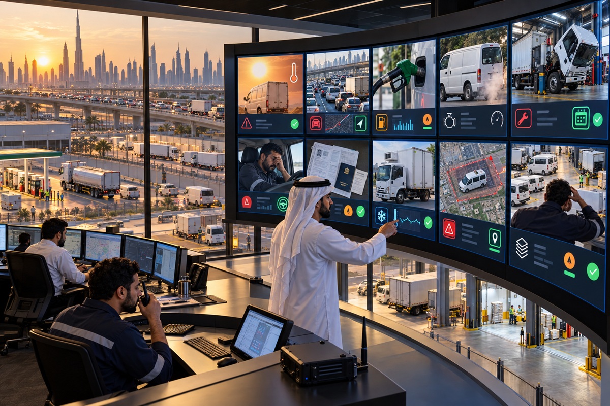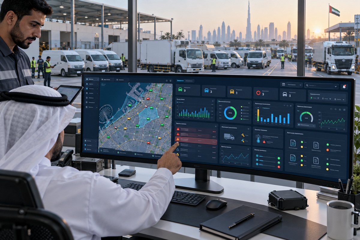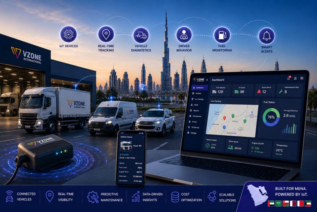
The UAE is building one of the world’s most connected transport ecosystems. Abu Dhabi’s smart city initiatives are integrating commercial fleet data with urban traffic management infrastructure. Dubai’s RTA has progressively expanded its digital transport programmes from SecurePath GPS compliance to broader connected vehicle data sharing. And UAE fleet operators who previously tracked vehicles are now monitoring vehicle health, cargo condition, driver biometrics, fuel consumption, tyre pressure, and environmental sensors all from a single cloud intelligence platform that turns data from dozens of sensors per vehicle into operational decisions in real time.
This is IoT fleet management and it represents a fundamental shift from where the fleet tracking industry was five years ago. Standard GPS tracking answers the question ‘where is this vehicle?’ IoT fleet management answers the much richer set of questions: what condition is this vehicle in, what is happening inside the cargo compartment, is this driver about to fall asleep, how many engine hours before this component needs replacement, and what does the historical movement pattern of this entire fleet tell us about where our depots should be located?
This guide explains what IoT fleet management actually means beyond the technology terminology, what specific sensors are deployed in modern UAE fleet vehicles, what location intelligence delivers that standard fleet reporting cannot, and how UAE’s smart city and electric vehicle programmes are creating new fleet connectivity requirements that IoT platforms are specifically positioned to address.
Key Takeaways
- IoT fleet management extends GPS vehicle tracking into a multi-sensor intelligence platform capturing engine health, fuel level, tyre pressure, cargo temperature, driver biometrics, and operational data from every monitored asset simultaneously.
- The CAN bus is the data backbone of modern IoT fleet monitoring providing access to hundreds of vehicle health parameters that OBD-II port and GPS alone cannot capture, enabling predictive maintenance that prevents breakdowns before they occur.
- Location intelligence the analytical layer built on historical GPS and sensor data generates business insights that real-time tracking alone cannot: depot location optimisation, territory coverage analysis, route efficiency trends, and customer dwell time patterns.
- Abu Dhabi’s ITC Asateel platform is one of the most advanced commercial fleet data integration programmes in the GCC, and IoT fleet platforms that natively connect with Asateel’s data sharing API provide compliance and intelligence benefits beyond basic GPS registration.
- Electric bus and EV fleet monitoring adds battery state-of-charge, range prediction, charging status, and regenerative braking data to the standard GPS and behavior monitoring stack requiring IoT platforms with EV-specific sensor integration.
- Wialon the enterprise fleet platform that VZone International operates on supports over 3,400 connected device types, making it the most hardware-flexible IoT fleet platform available in the UAE market.
What Is IoT Fleet Management?
IoT fleet management is the integration of Internet of Things (IoT) technology networked sensors, edge computing devices, and cloud intelligence platforms with commercial vehicle and asset management. Where standard GPS tracking collects one primary data stream (location), IoT fleet management collects dozens: GPS position, vehicle speed and heading, engine RPM and temperature, fuel level and consumption rate, tyre pressure and temperature, cargo compartment temperature and humidity, driver eye state and facial analysis, door and ignition events, CAN bus vehicle health data, and environmental condition data from fixed or portable IoT sensors attached to assets.
The cloud platform that receives all of this data running at the scale of millions of data points per minute from thousands of connected vehicles is where IoT fleet management generates its operational value. The platform does not simply display the data; it applies rules-based alerting, machine learning anomaly detection, predictive models trained on historical patterns, and analytics algorithms to convert the raw data streams into the actionable intelligence that fleet managers actually need: which vehicles are approaching maintenance thresholds, which drivers showed fatigue patterns today, which routes have the highest fuel cost per kilometre, which depot locations are suboptimal for tomorrow’s delivery territory.
IoT vs. Standard GPS Tracking The Key Differences
The distinction between standard GPS tracking and IoT fleet management is not simply a marketing differentiation it reflects a genuine architectural difference in what data is collected, how it is processed, and what operational decisions it enables. Standard GPS tracking focuses on vehicle location, speed, and behavioral events derived from accelerometer data. IoT fleet management extends this foundation with a sensor layer that monitors vehicle mechanical health, cargo condition, and driver physiological state simultaneously.
The practical operational difference is the shift from reactive to predictive management. Standard GPS tracking allows fleet managers to respond to events after they occur a vehicle breaks down, a driver exceeds a speed threshold, a cargo temperature excursion is confirmed. IoT fleet management enables prediction: a vehicle whose oil pressure trends over 30 days suggest bearing wear before the bearing fails; a driver whose blink rate patterns over a shift indicate fatigue onset before a microsleep event occurs; a cargo compartment whose temperature trend indicates reefer compressor performance degradation before a full failure occurs. Prediction enables intervention before cost.
What IoT Sensors Monitor in a Fleet Vehicle
| Sensor / Module | What It Monitors | Data Output | Primary Fleet Benefit |
| GPS module (GNSS) | Location, speed, heading, mileage | Real-time position every 5–30 seconds | Compliance (Asateel, IVMS), route management |
| OBD-II port module | Engine RPM, coolant temp, fault codes, fuel consumption | Vehicle health parameters every 1–5 minutes | Predictive maintenance, engine fault early detection |
| CAN bus integration | Full vehicle diagnostic data (200+ parameters) | High-resolution vehicle health stream | Comprehensive predictive maintenance, driver efficiency |
| In-tank fuel level sensor | Fuel volume, fill-up events, drain events | Level % every 2–5 minutes | Theft detection, consumption analysis, cost per km |
| TPMS (tyre pressure sensor) | Individual tyre pressure + temperature | Per-tyre readings, threshold alerts | Blowout prevention, tyre wear management, fuel efficiency |
| IoT temperature sensor | Cargo compartment or cabin temperature | Temperature every 1–5 minutes | Cold chain compliance, HACCP/GDP documentation |
| AI dashcam (driver-facing) | Fatigue, phone use, distraction, drowsiness | Event-based video clips + AI classification | Driver safety, IVMS compliance, insurance evidence |
| 3-axis accelerometer | Harsh braking, acceleration, cornering, impact | G-force events above threshold | Driver behavior monitoring, accident analysis |
| Door and ignition sensor | Door open/close events, ignition on/off, engine hours | Event timestamps | Security, utilisation tracking, maintenance scheduling |
| TPMS + load sensor (heavy vehicles) | Axle load + tyre pressure under load | Per-axle load distribution | Overload prevention, road compliance, tyre protection |
What Is Location Intelligence in Fleet Management?
Location intelligence is the analytical discipline that converts accumulated GPS and sensor data from fleet operations into strategic business insights. Where real-time tracking shows where a vehicle is now, location intelligence shows what patterns, inefficiencies, and opportunities exist across the entire historical operational dataset insights that are invisible from individual trip records but emerge clearly from the analysis of thousands of trips over months or years.
Beyond the Dot on the Map Business Insights from Location Data
The most commercially valuable insights from location intelligence are often not operational but strategic. A UAE logistics company that has been operating for three years with a single depot in Dubai’s Jebel Ali Free Zone has, in its GPS fleet data, the complete movement history of every vehicle for those three years including the geographic distribution of every delivery stop, the average travel time to each delivery cluster, and the frequency distribution of stops across different city zones. Location intelligence analysis of this dataset can definitively answer the question: ‘Would opening a second depot in Business Bay or Al Quoz reduce our total fleet distance by more than its operating cost?’ a decision that management has been making on intuition that data can actually resolve.
This type of depot location optimisation, territory redesign, and fleet sizing analysis based on actual historical operational data rather than estimated demand models is available to any fleet operator whose GPS platform stores historical data with enough granularity to support it. The barrier is not data availability but analysis capability: most fleet operators have the data, but lack the analytical tools or the provider support to extract these strategic insights from it.
Heatmaps, Dwell Time, and Territory Analysis
Heatmap analysis visualises vehicle density patterns across geographic areas showing which zones of a city generate the most vehicle activity, where traffic concentration creates the highest operational costs, and where the fleet is consistently absent despite the presence of potential customers or service points. For sales force fleets, heatmaps reveal which territories are receiving disproportionate coverage and which are underserved enabling territory redesign that improves sales coverage equity without increasing fleet size.
Dwell time analysis measures how long vehicles spend at specific locations depots, customer sites, fuel stations, and unscheduled stops. High average dwell time at a customer site may indicate a service delivery process that creates unnecessary waiting; high dwell time at a fuel station may indicate queue-based idling that could be addressed by changing fuelling time windows; high dwell time at depot after route completion may indicate driver administration overhead that process improvement could reduce. Dwell time data converts what operations managers previously experienced as vague inefficiency into specific, addressable process problems with measurable time and cost implications.
Predictive Routing from Historical Location Intelligence
Historical GPS data accumulated over months of fleet operations contains rich patterns that predictive routing algorithms can exploit to improve future route planning. Specifically, historical journey time data on specific route segments at specific times of day the actual time it took to travel between two points on a Tuesday morning versus a Thursday afternoon, in summer versus in Ramadan, during major UAE events versus normal periods provides a traffic prediction model based on real operational experience rather than general mapping platform traffic estimates.
Route optimisation algorithms that use this historical journey time data for the fleet’s specific routes produce ETAs that are more accurate for UAE conditions than those based on generic traffic models. A fleet that has delivered to Business Bay every morning for two years has 500 data points for the journey time from the Jebel Ali depot to Business Bay at 8:30am on weekday mornings far more locally specific than any general traffic prediction service can provide.
IoT for Abu Dhabi Smart City – Fleet Applications
Abu Dhabi’s smart city programme implemented through the Abu Dhabi City Brain and the ITC’s integrated transport management framework creates specific opportunities and obligations for commercial fleet operators that go beyond basic GPS compliance. As the emirate’s transport infrastructure becomes more connected, fleet operators whose technology platforms can interface with smart city data services gain operational advantages that those on legacy GPS systems cannot access.
Connected Vehicle Data Sharing with ITC Abu Dhabi
The ITC’s Asateel platform already functions as a vehicle data sharing system requiring GPS data transmission from all registered commercial vehicles to the ITC portal. The next evolution of this relationship is bidirectional data exchange: commercial fleet operators providing real-time vehicle data to the ITC’s traffic management system, and the ITC providing real-time traffic intelligence back to fleet operators’ routing and dispatch systems. IoT fleet platforms with ITC Asateel API integration are positioned to participate in this data exchange as it develops receiving smart city traffic intelligence that improves route optimisation accuracy beyond what commercial mapping platforms alone provide.
Fleet operators whose GPS platforms do not integrate with Asateel at the API level relying instead on manual portal registration and periodic data uploads will be progressively less able to benefit from the intelligent transport management capabilities that the ITC’s smart city programme is building. The technology investment decision is therefore not just about current compliance but about future access to urban intelligence infrastructure that connected fleet operators will leverage competitively.
Electric Bus Monitoring Abu Dhabi’s EV Fleet Initiative
Abu Dhabi’s public transport authority has progressively expanded its electric bus fleet as part of the emirate’s sustainable transport agenda. Electric buses introduce monitoring requirements that are distinct from diesel bus fleet management and that standard GPS telematics platforms are not designed to address without EV-specific sensor integration. Electric bus IoT monitoring covers battery state-of-charge in real time, remaining range prediction based on current battery level, terrain profile, and passenger load, charging status and session monitoring including charge rate, energy delivered, and time to full charge, regenerative braking performance analysis, and battery health trending over the operational lifetime of the vehicle.
For school bus operators and private transport companies in Abu Dhabi transitioning vehicles to EV models, the monitoring platform investment needs to anticipate these EV-specific data requirements rather than being forced into a retrofit when the existing GPS platform cannot handle battery and charging data. VZone International’s platform includes EV monitoring capability for fleets transitioning to electric vehicles, with sensor configurations for both pure electric and hybrid commercial vehicles.
Smart Traffic Integration for Fleet Dispatching
Smart traffic management systems variable message signs, dynamic speed limits, real-time incident detection, and connected traffic signal timing are expanding across both Dubai and Abu Dhabi. Fleet dispatching platforms that integrate with these smart traffic data feeds can route vehicles around incidents before the incident appears in consumer mapping apps, comply dynamically with variable speed limit zones rather than relying on static road speed data, and coordinate with traffic signal timing systems to minimise waiting time at signalised intersections on high-frequency delivery routes.
The practical application for commercial fleet operators is routing accuracy that improves progressively as smart traffic infrastructure density increases a compounding benefit of being on an IoT-connected fleet platform as UAE cities invest in their connected transport ecosystems.
IoT Fleet Management for MENA Expansion
UAE-headquartered fleet operators and logistics companies expanding into Saudi Arabia, Oman, Kuwait, Bahrain, and Egypt face fleet management challenges that add complexity to the UAE-only operating context: different country compliance requirements, varying cellular network coverage quality, intermittent connectivity in remote industrial zones, and the need for unified visibility across operations spanning multiple countries from a single platform.
Cross-Border IoT Connectivity UAE, Saudi Arabia, Oman
IoT fleet management for MENA cross-border operations requires devices configured for multi-country cellular roaming automatically connecting to the strongest available network in each country rather than a single operator’s coverage footprint. SIM cards with regional MENA roaming agreements, or dual-SIM configurations with local operator SIMs in each operating country, maintain connectivity across borders without manual SIM changes. The data from all vehicles across all countries feeds the same cloud platform, presenting operations managers with a unified MENA fleet view regardless of which country each vehicle is currently operating in.
Cross-border compliance management is a parallel requirement: the same IoT platform must generate ADNOC IVMS-formatted reports for UAE oil field operations, OPAL-formatted compliance data for Oman, and the specific GPS compliance documentation requirements that Saudi Arabia’s ZATCA and Ministry of Transport increasingly mandate for commercial fleets. A platform that handles country-specific compliance reporting from a single data source eliminates the multi-system management overhead that cross-border fleet operators using separate national tracking systems consistently face.
Low-Connectivity Zone Solutions Satellite Fallback
MENA logistics operations routinely involve routes through areas with minimal or absent cellular network coverage remote desert routes in Saudi Arabia’s Rub’ al Khali, construction logistics in early-stage development zones, mining and resource extraction operations in unpopulated desert regions. Standard cellular-only IoT devices lose data transmission capability entirely in these areas, creating operational blind spots and compliance data gaps that are unacceptable for safety-critical or compliance-sensitive applications.
Satellite IoT devices using Iridium, Inmarsat, or similar low-orbit satellite networks maintain continuous data transmission regardless of cellular coverage, at the cost of higher data transmission costs and typically lower transmission frequencies than cellular devices. The practical configuration for MENA fleet operations is a hybrid approach: cellular primary transmission with satellite fallback that activates automatically when cellular signal drops below a usable threshold. This configuration maximises data transmission quality and frequency while ensuring that remote zone operations are never completely invisible on the operations dashboard.
Edge computing is an emerging capability relevant to low-connectivity fleet operations: IoT devices with local processing capability that can make autonomous operational decisions triggering safety interventions, logging compliance events, maintaining sensor data records without requiring a live cloud connection. An edge-capable IoT device on a vehicle in a Saudi desert without cellular coverage can still detect a fatigue event, log a fuel drain alert, and maintain a complete sensor data record for upload when connectivity is restored, rather than simply creating a blank gap in the monitoring record.
VZone International’s IoT Fleet Platform
VZone International’s IoT fleet management capability is built on the Wialon platform one of the most extensively deployed enterprise fleet IoT platforms globally, with over 3,400 supported connected device types, 2,700+ operating companies across 130+ countries, and a cloud architecture processing data from over three million connected objects simultaneously. For UAE and MENA fleet operators, this global platform foundation provides the hardware flexibility, integration ecosystem depth, and processing scale that locally built or proprietary platforms cannot match.
Wialon IoT Integration 3,400+ Device Types Supported
The 3,400+ device type support in Wialon means that fleet operators can connect virtually any commercial GPS tracker, IoT sensor, OBD-II module, AI dashcam, or specialised monitoring device to the platform without bespoke development work. As UAE fleet operators upgrade hardware, add new sensor types, or integrate new asset categories EV buses, TPMS sensors, advanced AI cameras the platform accommodates the new device type from its existing library rather than requiring a custom integration project. This hardware flexibility is particularly valuable for the MENA market where the diversity of fleet asset types and the pace of technology adoption across different sectors creates a wide range of device integration requirements.
Location Intelligence Dashboard
VZone’s location intelligence module provides fleet operations managers and senior management with the analytical layer above the operational monitoring view: zone heatmaps showing vehicle activity density by geographic area, dwell time analysis by location type and customer category, route efficiency trend reporting comparing current month against historical performance, and depot-to-delivery distribution mapping that supports network design decisions. The intelligence dashboard is designed for non-technical users operations directors and business analysts who need data-driven decisions rather than raw telemetry feeds with configurable report templates and automated scheduled delivery to management email inboxes.
Electric Bus and EV Fleet Monitoring
VZone International supports EV fleet monitoring for operators transitioning commercial vehicles and buses to electric powertrains providing battery state-of-charge tracking, range prediction, charging session monitoring, and battery health analytics alongside the standard GPS, behavioral, and compliance monitoring that applies equally to diesel and electric vehicles. For UAE school bus operators and public transport contractors planning or executing EV fleet transitions, VZone’s platform provides the monitoring continuity that ensures EV vehicles are managed to the same operational intelligence standard as the diesel fleet they replace.
Conclusion: IoT Fleet Management Is the Infrastructure Layer for the UAE’s Connected Transport Future
The UAE’s investment in smart city infrastructure, connected transport systems, and sustainable fleet programmes is creating an operating environment where IoT-connected fleets will have measurable competitive advantages over those relying on standard GPS tracking. The ITC’s Asateel evolution toward bidirectional data exchange, Abu Dhabi’s electric bus monitoring requirements, and Dubai’s smart traffic integration ambitions all point toward a near-term future where the value of fleet technology is determined not just by what sensors are installed but by what those sensors connect to.
For fleet operators making technology investment decisions today, the practical implication is to choose platforms built on open, scalable architectures like Wialon that can accommodate new sensor types, new regulatory integration requirements, and new smart city data partnerships as they emerge, rather than proprietary systems that require disruptive platform migrations to expand capability. The IoT layer that today provides predictive maintenance and driver safety monitoring will, in the near term, also provide smart city integration, EV fleet management, and cross-border MENA intelligence and the fleet operators on connected platforms will access those capabilities progressively rather than having to replace their infrastructure to reach them.
VZone International’s twenty-year history of UAE fleet technology operations has been defined by precisely this kind of progressive capability expansion from basic GPS tracking to full fleet telematics, from compliance registration to predictive intelligence, from UAE-only to multi-country MENA coverage. The IoT era continues that trajectory, with the platform depth and the UAE regulatory knowledge to serve fleet operators at whatever point they are on the journey from location awareness to full operational intelligence.
Ready to connect your UAE fleet to the intelligence layer it deserves?
VZone International’s IoT fleet platform turns every vehicle into a live data source GPS, engine diagnostics, fuel sensors, AI cameras, temperature monitoring, and location intelligence on the Wialon enterprise platform with 3,400+ device types supported. Get a platform overview today and see what connected fleet intelligence looks like for your operation.
Frequently Asked Questions
IoT fleet management extends standard GPS vehicle tracking into a multi-sensor intelligence platform collecting data from GPS, OBD-II engine diagnostics, fuel sensors, tyre pressure monitors, temperature sensors, AI dashcams, and CAN bus vehicle health systems simultaneously. Standard GPS tracking answers 'where is this vehicle?' IoT fleet management answers 'what condition is this vehicle in, what is the driver doing, what is happening to the cargo, and which components are approaching maintenance failure?' enabling predictive management rather than reactive response.
The best IoT fleet solutions for the Middle East combine GPS tracking, OBD-II engine monitoring, fuel sensors, AI dashcams, cold chain temperature sensors, and TPMS into a unified cloud intelligence platform with multi-country coverage across UAE, Saudi Arabia, Oman, and Kuwait. The platform must support local compliance programmes ADNOC IVMS, ITC Asateel, OPAL Oman while providing the cross-border connectivity and satellite fallback capability that remote MENA operations require. VZone International provides this integrated IoT fleet platform built on Wialon.
Location intelligence analyses historical and real-time GPS data to generate business insights beyond operational monitoring. Applications include zone heatmaps showing vehicle activity density, dwell time analysis identifying time waste at specific locations, territory coverage gap detection for sales or service fleets, optimal depot location analysis based on actual historical delivery patterns, and predictive route timing models built from the fleet's own historical journey data. Location intelligence converts fleet GPS data from an operational monitoring tool into a strategic planning resource.
Abu Dhabi's ITC Asateel platform functions as a vehicle data sharing system requiring GPS data from all registered commercial vehicles. IoT fleet platforms with ITC Asateel API integration provide bidirectional data connectivity sharing vehicle data with the ITC's traffic management system and receiving smart city traffic intelligence in return. As Abu Dhabi's smart city programme expands, connected IoT fleet operators gain access to urban intelligence infrastructure real-time incident data, dynamic speed limit compliance, traffic signal coordination that improves routing and operational performance beyond what commercial mapping platforms provide.
VZone International provides IoT fleet management across UAE and the wider MENA region, built on the Wialon enterprise IoT platform with support for 3,400+ device types. VZone's UAE-specific capabilities include ITC Asateel integration, ADNOC IVMS compliance, RTA SecurePath compatibility, SIRA approval, OPAL certification for Oman, EV fleet monitoring, and location intelligence analytics — combined with 20+ years of UAE fleet technology experience and UAE-based implementation and support teams.
Modern UAE fleet vehicles use a multi-sensor IoT stack: a GPS GNSS module for location and compliance data; an OBD-II or CAN bus integration module for engine health and fault monitoring; an in-tank fuel level sensor for theft detection and consumption analysis; a TPMS module for tyre pressure and temperature; IoT temperature sensors for cold chain cargo monitoring; an AI dashcam for fatigue and distraction detection; a 3-axis accelerometer for harsh event detection; and door and ignition sensors for utilisation and security monitoring. Wialon VZone's platform supports all of these simultaneously from a single connected device configuration.